
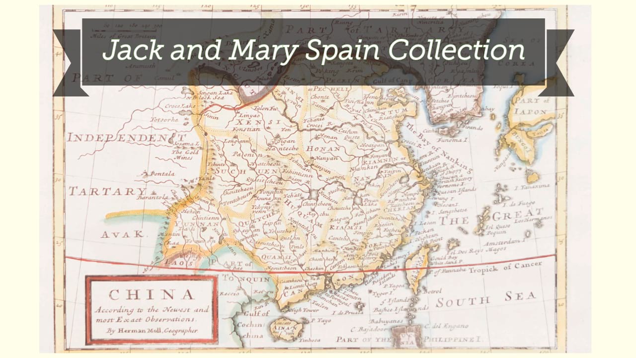
China and Birmah / the map drawn & engraved by J. Rapkin ; the illustrations by A.H. Wray & engraved by J.B. Allen.
| Author/creator | Rapkin, J. cartographer. |
| Format | Map |
| Publication Info | London : J & F. Tallis, [1851?] |
| Description | 1 map ; 23 x 30 cm on sheet 27 x 37 cm |
| Supplemental Content | National Library of Australia copy |
| Subjects |
| Other author/creator | Martin, Robert Montgomery, 1803?-1868. https://id.oclc.org/worldcat/entity/E39PBJmdpwD9HP4QfBYg3CDQbd |
| Other author/creator | Allen, James Baylis, 1803-1876, engraver. https://id.oclc.org/worldcat/entity/E39PBJtCyWcWyYQYqQRGbtQpfq |
| Other author/creator | Wray, A. H., illustrator. |
| Other author/creator | J. & F. Tallis (Firm), publisher. |
| Cartographic data | Scale [ca. 1:14,000,000] (E 85°--E 127°/N 42°--N 15°). |
| Local note | Joyner Rare vault copy is hand colored (outline). |
| General note | Map of China and Burma with relief shown by hachures. |
| General note | Prime meridian: Greenwich. |
| General note | From: The illustrated atlas and modern history of the world, geographical, political, commercial and statistical / R. Montgomery Martin. London : J. & F. Tallis, [1851?]. |
| General note | Map imprint: J. & F. Tallis London Edinburgh & Dublin. |
| General note | Six vignettes: British factories in Canton, a Wealthy man, Sedan-chair and sedan bearers, Chinese soldiers, the Hong Kong harbour, and a Chinese pagoda. Decorative border and title cartouche. |
| Digital Bookplate | Bookplate for Jack and Mary Spain |
| Other forms | Also available in an electronic version via the World Wide Web. |
| Acquisitions source | Joyner Rare vault copy gift of Jack and Mary Spain, 6/19/2024 |
| Genre/form | Maps. |
| Genre/form | Maps. |