
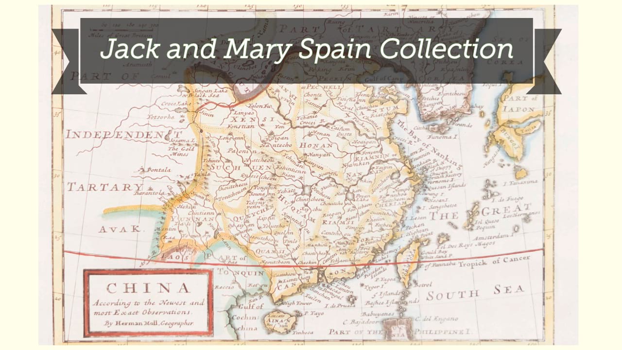
Province de Chen-Si / Guélard sc.
| Author/creator | Anville, Jean Baptiste Bourguignon d' cartographer. |
| Other author | Du Halde, J.-B. (Jean-Baptiste), 1674-1743. |
| Other author | Delahaye, Jean-Baptiste-Henri, -approximately 1755 engraver. |
| Other author | Guélard, Jean-Baptiste-Antoine, 1719-approximately 1755, engraver. |
| Format | Map |
| Publication | [Paris] : [P.G. Le Mercier], [1735] |
| Description | 1 map ; 46 x 52 cm on sheet 51 x 67 cm |
| Subjects |
| Cartographic data | Scale approximately 1:2,000,000. |
| Local note | Joyner Rare vault copy is hand colored. |
| General note | Relief shown pictorially. |
| General note | Scale given in Lis ou stades Chinois and Lieues communes de France. |
| General note | In lower left margin: "Gravé par Delahaye." |
| General note | In upper left margin: "Tom. 1, pag. 206". |
| General note | Title cartouche illustrated with trees, animals, spears, shields, and arrows. |
| General note | From Du Halde. Description geographique, historique, chronologique, politique, et physique de l'empire de la Chine et de la Tartarie chinoise (Paris : P.G. Le Mercier, 1735). This and other maps later appeared re-engraved in a pirated Dutch edition in 1737.--Cf. M. Cams. The China maps of Jean-Baptiste Bourguignon d'Anville: origins and supporting networks. In: Imago Mundi, 66 (1):51-69. |
| General note | "The maps by Anville ... originated from those of Jesuit missionaries based in China, and one of the main sources was the woodblock Chinese atlas known as the Kangsi Jesuit atlas which was completed in 1718 or 1719."--Cf. Shirley. Maps in the atlases of the British Library. |
| Digital Bookplate | Bookplate for Jack and Mary Spain |
| References | Maps in the atlases of the British Library, T.HALD-1a#12 |
| Acquisitions source | Joyner Rare vault copy gift of Jack and Mary Spain, 6/19/2024 |
| Genre/form | Maps. |
Availability
| Library | Location | Call Number | Status | Item Actions |
|---|---|---|---|---|
| Joyner | Rare Vault | G7823.S3 1735 .A58 | ✔ Available | Request Material |